![[New Zealand map]](NewZealand-map.jpg)
(Click to enlarge.) The blue line is the outbound path and the green line is the return path. For those that want to follow along, I took:
Motoring in New Zealand,
or, Driving on the Left Side of the World
These are pictures from my trip to New Zealand in October 2001.
(Click to enlarge.) The blue line is the outbound path and the green line is the return path.
For those that want to follow along, I took:
Click on any picture to see a bigger version. Note that the big versions may be up to 672K.
◄Previous 1 2 3 4 5 6 7 8 9 10 11 12 13 Next►
![[Auckland Harbor Bridge]](big/P1001030.jpg)
Auckland Harbor Bridge, as seen from the Sky Tower.
This is State Highway 1 (SH 1).
![[Harbor Bridge underneath]](big/P1001072.jpg)
The underside of the bridge. The center span was opened in 1957, and the
Japanese-built "Nippon Clip-Ons" were added to the outside in
1969.
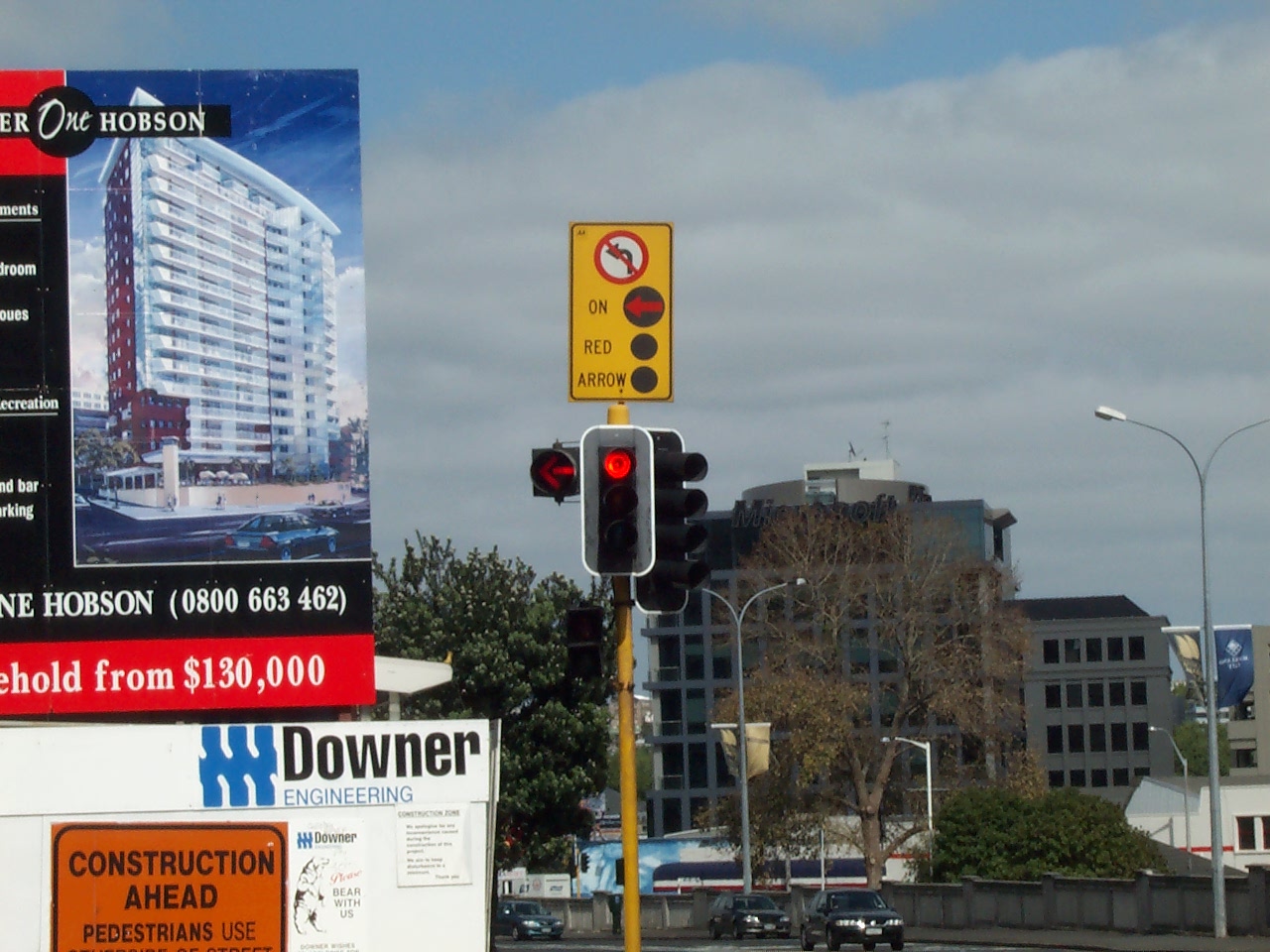
A typical restrictive signal in Auckland. Note that since traffic
drives on the left side of the roadway, a left turn is equivalent to a
North American right turn. Turns on red are not allowed in New Zealand. The
red arrow is to give pedestrians a chance to cross without conflicting
traffic.
![[Pedestrian detector]](big/P1001037.jpg)
A typical pedestrian detector. The arrow plate vibrates when the walk
signal is on, for the benefit of vision-impaired pedestrians. Normally
the pedestrian signals are dark until a button is pressed. Then, the
"Don't Walk" symbol lights. After going through the "Walk"
and flashing phase, the pedestrian signals go dark again.
![[City street]](big/P1001070.jpg)
City street with two-way right turn lane in the center.
![[Urban street]](big/P1001080.jpg)
Urban streetscene downtown. Note the protected right-turn signals.
Despite driving on the left, for some reason this signal pole is over
the right lane.
◄Previous 1 2 3 4 5 6 7 8 9 10 11 12 13 Next►
Last updated 9/2/2002